| Torrential Rain From TD Two! |
| Mon, June 17, 2013 |
|
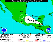
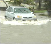
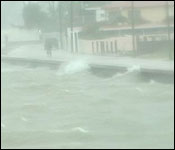 At this hour, Tropical Depression #2 is over Southern Belize near Monkey River with winds of 35 miles an hour. Now that is over land, the weather system is weakening but it has dumped and continues to dump torrents of rain – particularly on Southern Belize.
NEMO reports that
Mullins river is three feet above the temporary bridge on the Coastal Road and that is closed to vehicular traffic.
Further south, the North Stann Creek River is 3 ft above normal and rising in Middlesex, Pamona And Hope Creek.
The South Stann Creek River is also 3 ft above normal and rising.
Sittee River is 4 ft above normal and also rising.
Water is across the Hummingbird Highway at miles 13, 18 and 20 while the Bowman housing area at mile 15 is under 6 inches of water.
Today, the Chief Met Officer said they have been watching the system develop since Saturday.
Dennis Gonguez - Chief Meteorological Officer
 "We have been monitoring a very active Tropical Wave last week as it was forecast to affecting the country on Sunday. Sure enough we started getting the showers and thunder showers yesterday and this morning we have entered into more favorable conditions. The Tropical Depression formed about 2:00am and at that time it was 16.9N and 87.6W and that location is 60 miles south east of Monkey River and about 98 miles east north east of Punta Gorda. The depression had winds of 35 miles per hour and was moving towards west north west at about 13 miles per hour. The major threat from this system at this time is the rainfall. We could see an additional 2-3 inches coming out of this system. We've already had about 2 inches last night and so we can look at an additional two to three inches coming out of this system during this afternoon and tonight and tomorrow morning. As the system moves over the mainland this afternoon, the showers will be concentrating in the northern half of the country - Belize City northward where we could see 2.5 - 3 inches of rainfall over northern Belize. Then as the system exists and head westward then the concentration move the southern parts of the country where again you could see about 2.5 inches in the south. So we should be monitoring it in the even that your area is prone to flooding then you should be monitoring it to see if you're at risk."
Daniel Ortiz
"So when can residents expect improvement in the weather conditions?"
Dennis Gonguez
"When the system moves away we'll see some improvements starting tomorrow and we're not expecting as much rainfall tomorrow like we've been having yesterday and today. So we should see some improvements tomorrow and Wednesday as the system moves further away."
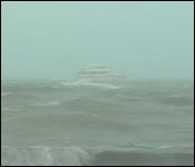
 All those living in flood prone areas, particularly in southern Belize are advised to be on the alert for flooding. And we note this particularly because while it may only be a tropical depression, in 2008 one of those caused terrible flash flooding in Southern Belize which resulted in the loss of 7 lives.
|

