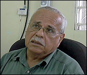
 And with the storm's position now said the be 120 miles east of Chetumal, Corozal is currently the closest place to the projected area of landfall which could be as high up as Punta Gruesa Mexico - but this is just a forecast. But in Corozal town at this very minute, we're told its not event drizzling, The NEMO Coordinator for told us how they are getting ready in that northern-most district.
Nemo Coordinator, Corozal
 "At this point we are at phase 3; 2 flags with the black dots are out already. We had been advised that we may be getting tropical storms forced winds. It should be making landfall between tonight and tomorrow morning between the northern part of the country and Quintana Roo. So between this evening or say from tonight into tomorrow we should be expecting some kind of change in this weather right now."
"We are preparing to open shelters this evening at 4 o'clock. We will be having 6 shelter open. We are concentrated mostly in the coastal areas, for example in the coast we have Sarteneja, Chunox, Copper Bank and Progresso and Consejo. In the town we would only open 2 shelters for now. If we see the need to open more shelters as we go along we are going to open it and advise the general public through the local media."
"So we will be having 6 shelters open for today at 4 o'clock. In the case of what the people should be expecting as advised by the MET office we will be having some heavy rains between 3 to 6 inches of rain. That calls for a lot rain, a lot of flooding. We will be open from 4 this evening all the way until when the storm is over. So we will be up all night, all day tomorrow until everything clears up. You can get me at 623-0237, that's my number and you can get the assistant coordinator which is Mr. Ronnie Hernandez at 637-2151. Our office number which is 402-3158."


