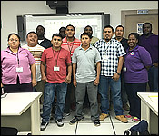
When you think about BDF or Coast Guard training - you think about weeks of strenuous exercises and brutal drills. Well, that wasn't the kind of training that 15 officers completed. They participated in a GIS introduction training course. It was held at the Central Information Technology Office in Belmopan. GIS stands for Geographic Information Systems, it is a way to record, interpret and analyze data using satellite imagery or maps. So the BDF and Coast Guard should now be able to use GIS in their national security efforts. The training lasted 6 days.


 When you think about BDF or Coast Guard training - you think about weeks of strenuous exercises and brutal drills. Well, that wasn't the kind of training that 15 officers completed. They participated in a GIS introduction training course. It was held at the Central Information Technology Office in Belmopan. GIS stands for Geographic Information Systems, it is a way to record, interpret and analyze data using satellite imagery or maps. So the BDF and Coast Guard should now be able to use GIS in their national security efforts. The training lasted 6 days.