 And from COVID, we turn now to the regional outlook on the weather, and specifically, Tropical Storm Cristobal.
As we told you earlier in the news, the rains caused by this weather system last weekend has caused the sugar industry to go on a temporary pause due to excess mud being delivered with the cane. And, that was done back when it wasn't even strong enough or organized enough to become a named storm.
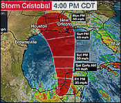
Well, it has now developed into a tropical storm with maximum sustained winds of 60 miles per hour. That was this morning's readings from hurricane experts. It is now moving at a crawl over Mexico, and the rains from this system will affect that country, as well as Belize and other neighboring Central American nations. It is forecasted that the storm could become a threat to the US Gulf Coast. It continues to drift southeastward at less than 5 miles per hour. Experts in Belize are forecasting that bad weather caused by the system will affect the northern districts at least into the upcoming weekend.
The National Hydrological Service within the Ministry of Natural Resources put out an updated flood forecast for today.
The Blue Creek sub-catchment of the Rio Hondo is flooded, and flood levels have reached 1.69 meters above the level historically recorded for Hurricane Mitch. The New River at Caledonia continues to rise slowly, and it is now at the bank-full stage. On the Macal River, reservoir levels remain below the spillways at the Chalillo, Mollejon, and Vaca Facilities. In San Ignacio, water levels remain below the low-lying bridge, but they are rising.
On the Belize River, levels at Banana Bank continue to fall. The Crooked Tree Lagoon is below the causeway and steadily rising. At Double Run, levels are also steadily rising. The Sibun River near Freetown Sibun is flooded and continues to rise.